
Bryce/Zion Photos
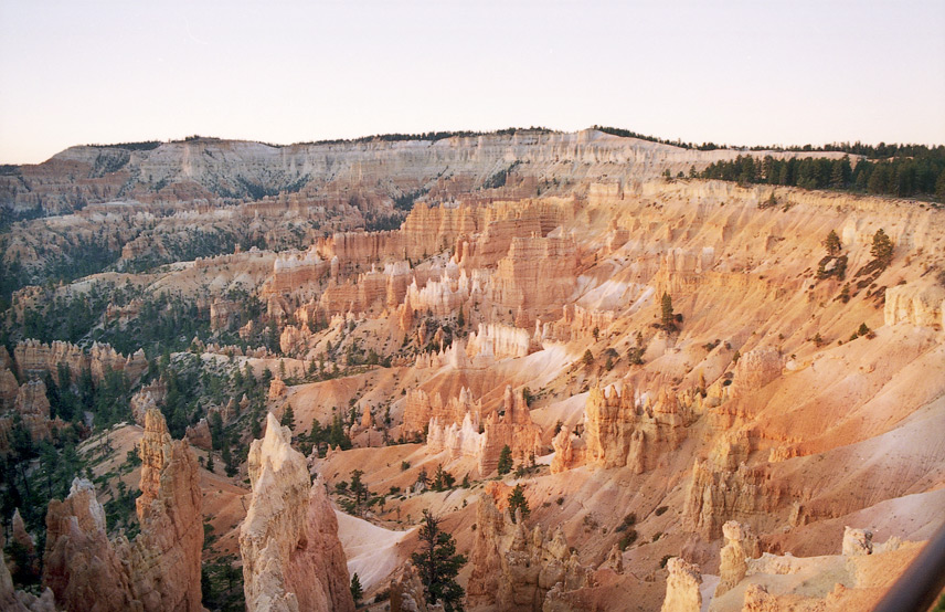
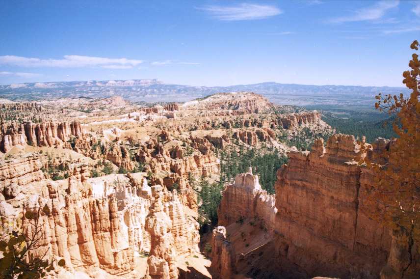
Bryce Canyon from Sunset Point
Boat Mesa, with "Sinking Ship" in background
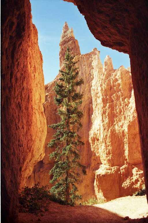
Douglas Fir along Pekaboo Loop Trail
All Images Copyright Steve
Cannistra
In October of 1998 I hiked Bryce and Zion Canyons in
Southern
Utah. I spent the first two days at Bryce Canyon and learned
first-hand
about the forces of erosion which shaped the well-known "hoodoos" for
which
Bryce is famous. (Hoodoos are the tall columns of rock which are
seen
in the photos below). The last three days were spent at Zion
Canyon, which was carved out by the Virgin River. At Zion we
hiked the Kolob trail, Observation Point, as well as the Virgin River
towards the Canyon
Narrows. The group was comprised of about 14 people, and we hiked
an average of 6-8 miles per day (range 4-14). I found it very
enjoyable
and highly recommend it to anyone interested in visiting the
area.
More information about this area may be found at the Great
Outdoor Recreation Pages. Click below to see my photos from
the Bryce
and Zion trips.
Bryce Facts
Bryce
is a wonderland of mysterious shapes and colors. The
area which encompasses Bryce, Zion, and the Grand Canyon is comprised
of
various layers of sedimentary rock deposited over a time period
spanning a half billion years. Parts of this region were once
comprised of lakes, subsequently filled in by iron oxide-containing
sediments deposited by the rivers draining into them. These
deposits are responsible for the
red-colored layers which are easy to see in the photos below.
(Manganese-containing sediments can also be occasionally found and
produce a purple hue to the
rock). At other periods the area was covered by the sea,
resulting
in the deposits of crustaceans whose shells are rich in calcium
carbonate
(producing limestone). These are responsible for the
white-colored
layers which are often seen in this region. Deposition of
sandstone
(comprised of minerals like quartz) and shale (which is basically rock
made
out of compacted mud from river bottoms) occurred throughout this
period
as well and is responsible for the yellows of Bryce (and the sandiness
of
Zion).
After all of this material was deposited, the entire region was lifted up about 10 million years ago to form high plateaus where lake bottoms once were. The Bryce canyon is located on the eastern rim of the plateau called "Paunsaugunt" and is a result of erosion of this area by rain, wind, and alternating freezing, thawing, and cracking of brittle rock. The rock layers exposed at Bryce represent the youngest of the region, dating back to the Cretaceous period (over 65 million years ago, around the time of the dinosaur extinction). In contrast, those of Zion date back to the Triassic (about 225 million years ago), and those of the Grand Canyon date back to over a half billion years ago.
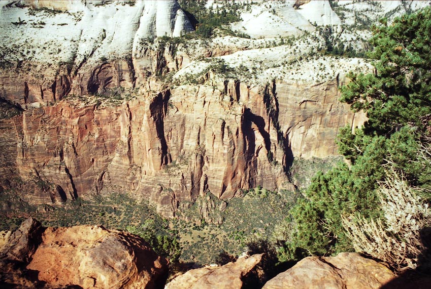
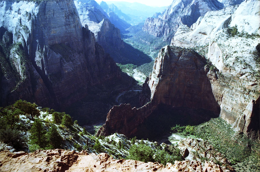
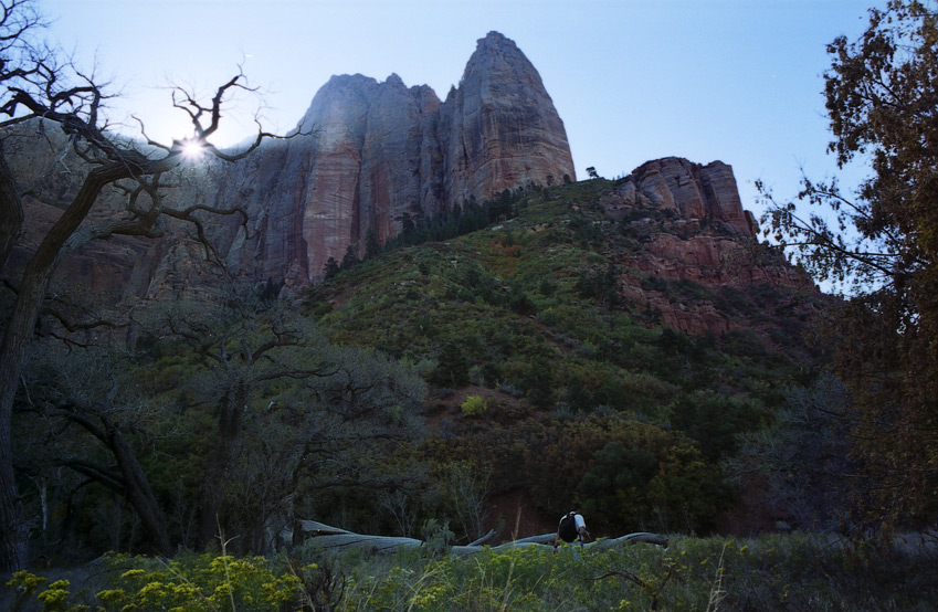
Zion Facts
Zion
is a majestic contrast of high shear monolithic cliffs which surround a
deep and imposing canyon. It was formed in a completely different
way than Bryce, namely through erosion by the Virgin River.
Although there is the occasional hoodoo, the area has a completely
different feel from Bryce for two main reasons. First, water from
the Virgin river
supports a great deal of plant and animal life. Second, the
canyon floor
of Zion is about 4,000 feet in elevation (as opposed to Bryce, which is
higher
at about 8,000 feet above sea level). Due to its lower elevation,
Zion
is warmer, many wildflowers were in bloom, sage and other grasses were
in
abundance, and there were lots of animals to observe, including mule
deer and a variety of birds.
Grand Canyon and Havasu Canyon